

GEOTRACE Tracker

Description of GEOTRACE Tracker
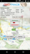
The GEOTRACE Tracker App is a GPS Tracking and Security Application for sending GPS data, service and alarm notification to the GEOTRACE server www.myGeotrace.de
The positions are visualized on maps, stored in a database with different available information like a roadbook, history tracking, speed control and much more shown in detailed reports. Different events like emergency, service, server sided geofencing, movement, speed and much more, will be controlled and can trigger a message as email, SMS, voice-call and satellite message.
If there is no GPS, the app use the location data from an available WiFi-network or from the next GSM-transmission tower.
Installation:
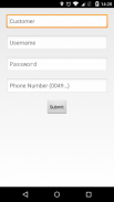
You have to ask for the account data, given by GEOTRACE (please contact via mail: info@geotrace.de).
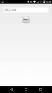
Use the Account data, wait for the SMS and finalize the installation with the SMS code.
Now app installation is finalized.
What's new in Version 2.0:
The Accelerometer is used to detect if the device has moved within about 3 minutes. If it has not, GPS is deactivated in order to save power. Once the device moves again, GPS is activated.
The sensitivity can be set from 0 to 10. 0 meaning never saving power, 10 meaning very in-sensitive. 0.5 seems to be a good default value.
- Encryption of transmitted data and settings using AES 256 [if activated].
- In case an alert is triggered, tracking is started automatically.
- In case of an assistance/emergency alert, call a separately definable telephone number ("Listen in") [if activated].
- When the device is shaken, an emergency alert ist automatically triggered [if activated].
Increases battery drain a bit. (Attention: Can easily trigger false alerts through vibration or malfunctioning devices!)
- In case the server is not reachable, sending data will resume after one minute. If the server answer seems unusual, sending will continue after 15 minutes.
- In case of network failure, data will also be sent via SMS ("Fallback"). Either only alerts or all data [if activated].
- A low battery level is reported to the server and reset after charging.
- Settings are only transmitted from server if they have changed.
- Support for English and German, depending on system settings.
- Alerts are sent with the last known position but retain a current timestamp.
- Display UTM and MGRS Coordinates as well as further data.
- Improved graphical interface.


